Mapping EMSO SmartBay in 3D: DIGI4ECO Pioneers New Approaches to Underwater Digital Twins
19 October 2026
From autonomous underwater vehicles to advanced ROV photogrammetry, two complementary surveys at SmartBay Observatory are helping to create one of the most detailed digital representations of a European coastal observatory yet. At the heart of the campaign was the EMSO SmartBay Observatory. The work aimed to investigate how underwater digital twins can support long-term environmental monitoring, infrastructure inspection and ecosystem assessment.
From autonomous underwater vehicles to advanced ROV photogrammetry, two complementary surveys at SmartBay Observatory are helping to create one of the most detailed digital representations of a European coastal observatory yet.
The DIGI4ECO project (https://digi4eco.eu/) is exploring how digital technologies can transform marine ecosystem monitoring, and during summer 2026 the project’s SmartBay demonstration site in Galway Bay, Ireland, became the focus of an ambitious underwater photogrammetry programme. Combining autonomous and remotely operated surveying approaches, project partners successfully collected imagery datasets that are now being transformed into high-resolution three-dimensional models of seabed habitats and marine infrastructure.
At the heart of the campaign was the EMSO SmartBay Observatory ,The work aimed to investigate how underwater digital twins can support long-term environmental monitoring, infrastructure inspection and ecosystem assessment.
Autonomous Photogrammetry with GRAALTECH and CORONIS
The first survey campaign was carried out in July using an autonomous underwater vehicle (AUV) provided by the Italian Company GRAALTECH (http://www.graaltech.com) and equipped with a stereo imaging system developed by CORONIS Computing in Spain (https://coronis.es/es/). Working alongside the Marine Institute, the team deployed the vehicle around SmartBay to demonstrate autonomous photogrammetric mapping in a challenging coastal environment.
Before arriving in Ireland, engineers from GRAALTECH and CORONIS completed the integration of the stereo camera system with the AUV platform. The resulting system was designed to acquire overlapping image sequences suitable for photogrammetric reconstruction while operating independently on pre-programmed survey lines.
The surveys highlighted both the promise and the complexity of underwater photogrammetry. To obtain imagery of sufficient quality, the AUV was required to travel slowly, approximately 0.3-0.4 m/s, while maintaining an altitude of only 1.5-2 metres above the seabed. This enabled the collection of high-resolution imagery but reduced overall survey coverage because each image captured only a relatively small section of seabed.
The CORONIS stereo imaging system was configured specifically for photogrammetric reconstruction, using overlapping imagery to create detailed three-dimensional representations of the marine environment. Initial processing demonstrated the capability of autonomous platforms to collect scientifically valuable mapping data around marine observatories and other sensitive coastal infrastructure.
However, the campaign also provided valuable lessons. Preliminary analysis indicated that the seabed imagery contained relatively low texture in places, making feature matching and image registration more challenging than anticipated. CORONIS researchers therefore undertook significant post-processing work to improve image alignment and generate accurate photomosaics from the acquired datasets.
Reaching the Observatory Core with XYZ Engineering
While the AUV campaign successfully mapped areas surrounding the SmartBay exclusion zone, a second survey was commissioned to investigate the more complex infrastructure located closer to the observatory itself. Because subsea cables and scientific installations presented an entanglement risk for autonomous vehicles, a separate photogrammetry campaign was undertaken by XYZ Engineering Ltd. using an advanced remotely operated vehicle (ROV) system.
The company deployed a customised JM Robotics HD3 platform known as ROV MIKE, fitted with a bespoke synchronised stereo camera system developed in-house. Importantly, the camera arrangement incorporates optical correction technology designed to compensate for underwater refraction effects, a factor that can significantly influence photogrammetric accuracy beneath the surface.
Data acquisition was completed during July 2026, after which processing began using advanced photogrammetric workflows. Early results were highly encouraging. According to project updates, image registration performance was strong and large sections of the observatory were successfully reconstructed as dense three-dimensional point clouds.
Interestingly, environmental conditions proved better than anticipated. Water clarity and colour did not significantly impact image quality. Instead, dynamic biological activity emerged as a greater challenge. Fish moving through the survey area complicated image matching and reconstruction processes, highlighting an often-overlooked difficulty associated with underwater photogrammetry in biologically active environments.
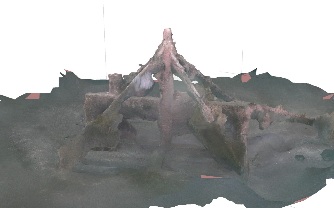
By August, the team had successfully generated three-dimensional meshes of SmartBay infrastructure, including observatory landers. Although heavy marine growth presented challenges for surface texturing, the survey demonstrated that detailed digital representations of long-term ocean observing infrastructure can be produced in situ using modern imaging technologies.
Towards a Complete SmartBay Digital Twin
One of the most exciting outcomes of the DIGI4ECO activities is the planned integration of datasets collected by both survey approaches. The CORONIS-GRAALTECH AUV campaign provides imagery and mapping information from outside the observatory exclusion zone, while the XYZ Engineering survey delivers highly detailed reconstructions of the infrastructure located within it. Together, these datasets will create a far more complete digital representation of the SmartBay site than either survey could achieve independently.
In parallel, researchers from Atlantic Technological University (ATU) and the Marine Institute collected environmental DNA (eDNA) samples during the same campaign period. Future work within DIGI4ECO aims to combine biological observations with photogrammetric datasets, opening opportunities to link species occurrence data with habitat structure and environmental conditions.
The SmartBay photogrammetry demonstrations represent an important step towards the development of operational marine digital twins, where real-world observations, imagery, biological measurements and environmental data can be brought together within a unified digital framework. As processing continues and datasets are prepared for publication, the results are expected to contribute to future EMSO activities, digital observatory developments and advanced ecosystem monitoring approaches across European coastal waters.
Photo 1 (cover): Graaletech and Coronis Technical Teams preparing to deploy the AUV at EMSO Smartbay Site in Galway Bay July 2026. Photo Credit: Paul Gaughan, Marine Institute
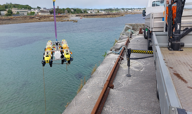
Loading Graaltech AUV from the Quayside after overnight charging prior to redployment. Photo Credit: Paul Gaughan, Marine Institute
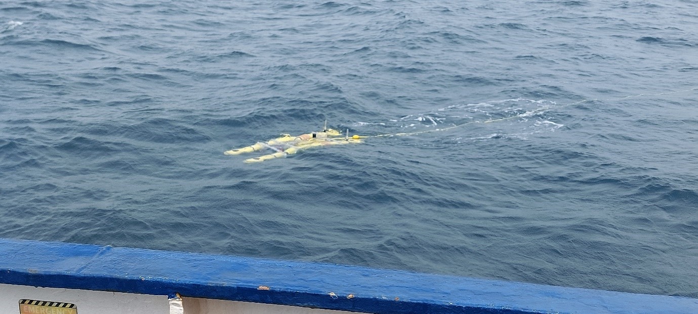
Graaltech AUV deployed at Emso Smartbay Site in Galway Bay. Photo Credit: Paul Gaughan, Marine Institute
Graaltech AUV deployed at Emso Smartbay Site in Galway Bay. Photo Credit: Paul Gaughan, Marine Institute
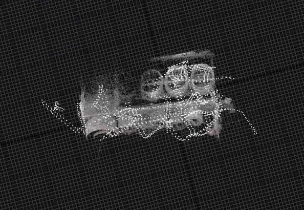
Nadir View of Emso Smartbay Observatory from JM Robotics HD3 platform known as ROV MIKE (Image from XYZ Technology Ltd.)
Author: Paul Gaughan, Marine Institute