

A seismological dataset of 1130 crustal and sub-crustal earthquakes, prevalently occurred in the Ionian Sea and the coastal area of south Calabria and Eastern Sicily, has been analysed to define the improvement in the location process gained with the use of NEMO-SN1 seafloor observatory (part of the EMSO Western Ionian Sea facility). The seismological dataset has been recorded by NEMO-SN1 during two deployment phases: October 2002 – February 2003 and June 2012-May 2013. During the time interval between the two NEMO-SN1 deployments, the seismic station coverage (prevalently broad-band seismic stations) was greatly improved on land. The analyses conducted in this study demonstrated that the increasing station coverage on land has not influenced the location of events occurring offshore, where NEMO-SN1 continues to be the foremost tool in the location process.
The integration of seismological data recorded both by the seismometer hosted in the seafloor observatory and the land stations showed a reduction in terms of mean and standard deviation computed on the azimuthal gap, rms, horizontal and vertical errors. This has been highlighted by analysing in detail 358 earthquakes of the dataset that occurred offshore. The authors of the paper compared the locations performed with and without travel-times from the seafloor observatory and found that the results illuminated the active tectonic structures placed in the Ionian Sea.
Moreover, similarities of locations and their new fault plain solutions computed integrating travel times from NEMO-SN1, are found between two events of the dataset and the main shock and aftershock of the 1990 earthquake (M= 5.6), demonstrating that the same seismic structures are still active and potentially dangerous.
The analysed area, the Western Ionian Sea, is characterized by active and diffusive seismicity, directly related to the convergence of the European and African Plates and by gravitational sinking and rollback of the ocean lithosphere. The choice of the site deployment of the NEMO-SN1 seafloor observatory is related both to the large earthquakes that experienced this area in the past and in recent times (e.g. the M=5.6 1990 earthquake) and the high volcanic hazards related to the Mt Etna volcano. Moreover, NEMO-SN1 allows the long-term monitoring of environmental processes related to marine ecosystems and climate change.
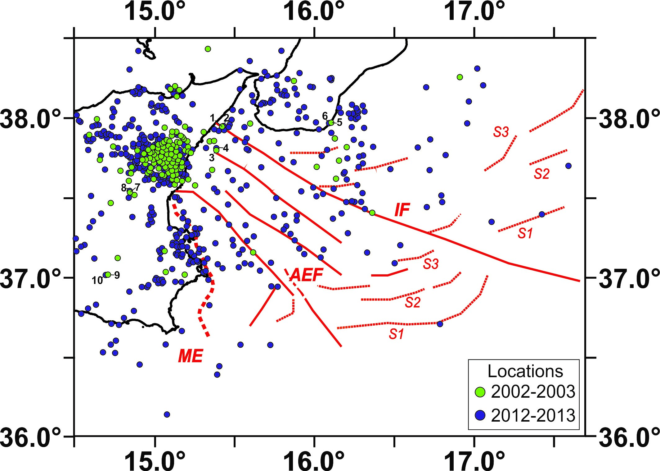
Figure caption: Map of seismicity recorded by NEMO-SN1 (1130 earthquakes) during the two deployment periods of the seafloor observatory: October 2002 –February 2003(green circles) and June 2012–May 2013 (blue circles). Main tectonic structures including Malta escarpment (ME), Alfeo-Etna Fault and Ionian Fault (AEF and IF; Polonia et al., 2016) and splay faults (S1, S2, S3) are sketched in red.
The contribution of the NEMO-SN1 seafloor observatory to improve the seismic locations in the Ionian Sea (Italy)
Tiziana Sgroi, Graziella Barberi, Alessandro Marchetti
ANNALS OF GEOPHYSICS, 64, 6, SE655, 2021; doi: https://doi.org/10.4401/ag-8575