

An international study, published in the journal Ecological Informatics, proposes a new operational strategy for the Digital Twin of the Ocean, making the observation and management of the Blue Planet more targeted, efficient, and proactive.
DECEMBER 18th, 2025 – The Digital Twin of the Ocean (DTO), the virtualization of a specific marine area designed to provide a better understanding of the current state of the marine environment and the impact of socio-economic activities to scientists, citizens, and decision- makers, is now a consolidated strategic priority, confirmed by the European Commission’s investments in projects and initiatives focused on DTO progress under the EU Mission Restore our Ocean and Waters, and central to the attention of the recent Digital Ocean Forum, held in Brussels on November 27-28, 2025.
A strategic study, resulting from an international European collaboration and published in the journal Ecological Informatics, proposes an operational solution aimed at elevating the DTO to an active and adaptive monitoring system. The study highlights how the different data collected from the marine environment by a network of autonomous mobile and fixed robotic platforms provide valuable tools to researches to optimize at-sea sampling studies, “directioning” underwater exploration and monitoring robots at specific points and times useful for maximizing research effectiveness and understanding ecological links in areas of particular interest (e.g., the restoration of fishery depilated areas).
“The Digital Twin of the Ocean aims to bring together a whole heterogeneous category of data that are currently independently compartmentalized and sometimes not fully exploited. We are talking about data of any nature: environmental, citizen data such as observations, data derived from fishing, or scientific data from oceanographic campaigns. All these multiparametric data coming from a specific region of the sea or ocean are aggregated in a spatio-temporal ‘matrix’, completed with data origins’ lables (i.e., metadata) for generating platform and sensor, as well as latitude, longitude, depth, and synchronized, or ‘aligned’ in time (what is defined in the study as a Data Bubble, editor’s note). Adopting this analytical methodology, we can precisely track how crucial elements of the marine ecosystem (e.g., species) evolve their descriptive parameters (e.g., abundance and biomass) in relation to other factors (e.g., oceanographic and metereological variables), studying their temporal co-variance” explains Jacopo Aguzzi, Senior Researcher at Instituto de Ciencias del Mar (ICM- CSIC), Spain, and first author of the study.
The research is already in the application phase in the field, particularly within the framework of the European project “Digital Twin-sustained 4D ecological monitoring of restoration in fishery depleted areas” (Digi4eco), funded by the European Commission. Here, two cabled underwater observatories, which ensure intensive and continuous collection of biological and environmental data, belonging to the European Research Infrastructure EMSO ERIC (European Multidisciplinary Seafloor and Water-column Observatories), and mobile technologies, such as AUV (Autonomous Underwater Vehicles), ROV (Remotely Operated Vehicles), crawlers and stand-alone landers ensure wide spatial coverage in association with nearby operating research vessels, finding full application and synergy to realize DTO progress.
The two EMSO ERIC sites currently on the front line in the project, OBSEA, in the Mediterranean Sea (Spain), directed by the Universitat Politècnica de Catalunya – BarcelonaTech (UPC), and SmartBay, in the Atlantic Ocean (Ireland), Marine Institute (MI), are demonstrating the effectiveness of combining robotic monitoring data with spatio-temporal modelling at multiple locations: at the Spanish OBSEA site, research focuses on studying the climatic and anthropogenic impacts on certain fish species of the Sparidae family (e.g., sea bream) and dolphins. The approach employs the collection of environmental data and video-imaging to study species richness and how environmental factors influence biodiversity.
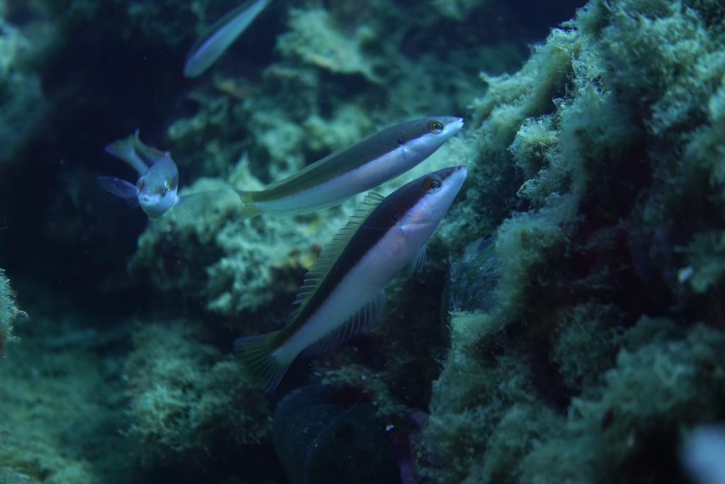
Figure. Some of the species that live around OBSEA – Coris julis. Credits: OBSEA – UPC
“Digital Twins are becoming indispensable for understanding how local ecosystems respond to restoration actions and climate pressures. Through Digi4Eco, OBSEA contributes unique long-term datasets and technological testbeds that help translate scientific knowledge into practical interventions to protect and recover marine habitats. At UPC, we see the Digital Twin of the Ocean as a catalyst for new engineering solutions that seamlessly connect advanced sensing, modelling, and adaptive decision-making—enabling a new generation of intelligent, sustainable marine observation systems”, says professor Joaquín del Río, director of Development Center of Remote Acquisition and Information Processing Systems (SARTI) at UPC and coordinator of OBSEA.

Figure. AI-based fish detection and classification trials at OBSEA. Credits: OBSEA – UPC
At the SmartBay site, located in Galway Bay, the main objective in this context is to investigate the individual behavioral interactions of the iconic fishery species Norway lobster (Nephrops norvegicus) with their burrows, through the use of autonomous imaging systems installed on the Marine Institute’s cabled observatory to closely observe and count individuals, tracking their behavioral patterns over time and thus contributing to a more precise stock estimate.
“The SmartBay observatory’s cabled infrastructure delivers continuous, high -resolution imaging and multi-parameter sensor data, forming the physical twin foundation for a 4D Digital Twin of Galway Bay in the DIGI4ECO project. This enables real-time behavioural tracking of Nephrops norvegicus, integrating AI-driven spatio-temporal analytics to model ecological responses and optimize restoration in fishery-depleted zones. By federating such Digital Twins across EMSO regional facilities, we enhance service provision to the broader EMSO ERIC through standardised data interoperability, predictive modelling tools, and scalable access to harmonized datasets, accelerating pan-European marine research and policy support” concludes Paul Gaughan, Scientific and Technical Officer with the Marine Institute’s Research Infrastructures Team.
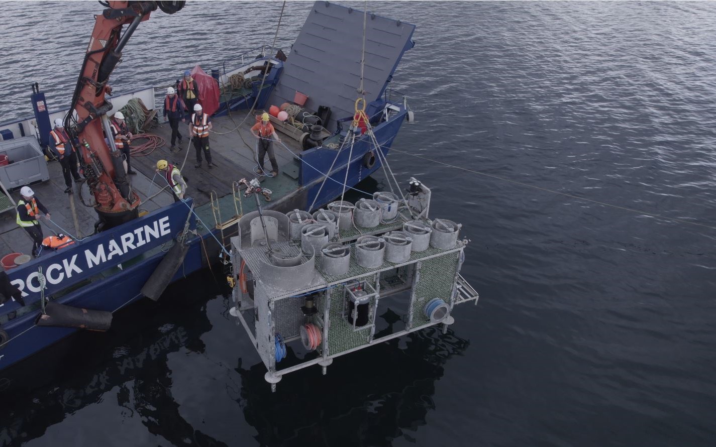
Background figure. SmartBay redeployed in Galway Bay after maintenance. Credits: Marine Institute